Path to Milton Brae
Introduction
The photograph on this page of Path to Milton Brae by Lairich Rig as part of the Geograph project.
The Geograph project started in 2005 with the aim of publishing, organising and preserving representative images for every square kilometre of Great Britain, Ireland and the Isle of Man.

There are currently over 7.5m images from over 14,400 individuals and you can help contribute to the project by visiting https://www.geograph.org.uk
Path to Milton Brae
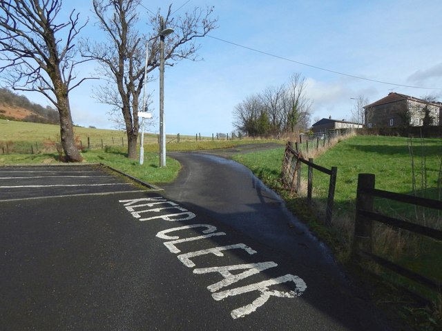
Image: © Lairich Rig Taken: 1 Mar 2017
Another photograph, Image, shows a short section of road leaving the A82 to lead uphill. The present picture is taken from the top of that road. As mentioned in the description for that picture, a route called the Crags Circular Path follows that road to this point, and then continues in the form of a path. That path passes the gate that can be seen not far ahead, and then continues directly ahead, beyond the left-hand side of the gate. (For a view from that gate, looking back to the point from which the present picture was taken, see Image) The houses on the right are on Image, but the Crags Circular Path does not follow that road; it instead follows a route between the houses and the field on the left.
Images are licensed for reuse under creativecommons.org/licenses/by-sa/2.0
Image Location
Latitude
55.935921
Longitude
-4.525217