
Road junction, North Darley
Introduction
The photograph on this page of Road junction, North Darley by Rob Farrow as part of the Geograph project.
The Geograph project started in 2005 with the aim of publishing, organising and preserving representative images for every square kilometre of Great Britain, Ireland and the Isle of Man.

There are currently over 7.5m images from over 14,400 individuals and you can help contribute to the project by visiting https://www.geograph.org.uk
Road junction, North Darley
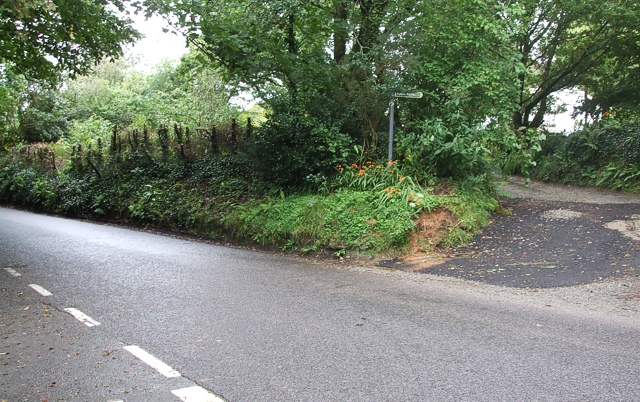
Image: © Rob Farrow Taken: 14 Aug 2007
Taken from where the lane from Rilla Mill hits the B3254. Ahead can be seen a track that briefly heads westwards into Darley Wood with a coincident footpath as can be seen from the sign. The orange flowers at the base of this sign are Montbretia a hybridised member of the Iris family similar to a small gladiolus. These attractive flowers form large patches covering roadside verges throughout this part of Cornwall, though I don't recall having seen them elsewhere in the country.
Images are licensed for reuse under creativecommons.org/licenses/by-sa/2.0
Image Location

Latitude
50.536519
Longitude
-4.429941