William Street, Botchergate, May 2013
Introduction
The photograph on this page of William Street, Botchergate, May 2013 by Rose and Trev Clough as part of the Geograph project.
The Geograph project started in 2005 with the aim of publishing, organising and preserving representative images for every square kilometre of Great Britain, Ireland and the Isle of Man.

There are currently over 7.5m images from over 14,400 individuals and you can help contribute to the project by visiting https://www.geograph.org.uk
William Street, Botchergate, May 2013
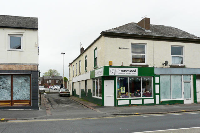
Image: © Rose and Trev Clough Taken: 19 May 2013
This short no-through road is all that remains of William Street, which used to be about four times longer. The 1865 OS map (OldMaps website https://www.old-maps.co.uk/#/Map/340510/555430/13/100107 - click small white map on LHS) shows terraces on both sides of the street with several courts behind, which we assume were back-to-back houses. By 1965 these had been cleared to create a car park, seen here in the distance. The buildings on the right were demolished in 2015, together with some adjoining properties - see Image . The site has been redeveloped with offices for Cumbria County Council, which opened in autumn 2016 - see Image .
Images are licensed for reuse under creativecommons.org/licenses/by-sa/2.0
Image Location
Latitude
54.890143
Longitude
-2.92897