North Dawlish from the former Pitch and Putt, Sandy Lane
Introduction
The photograph on this page of North Dawlish from the former Pitch and Putt, Sandy Lane by Robin Stott as part of the Geograph project.
The Geograph project started in 2005 with the aim of publishing, organising and preserving representative images for every square kilometre of Great Britain, Ireland and the Isle of Man.

There are currently over 7.5m images from over 14,400 individuals and you can help contribute to the project by visiting https://www.geograph.org.uk
North Dawlish from the former Pitch and Putt, Sandy Lane
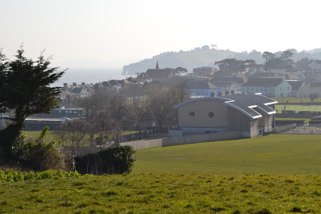
Image: © Robin Stott Taken: 14 Mar 2016
Dawlish Leisure Centre is in the middle distance with Dawlish Community College beyond it. Along the coast the Parson and Clerk, the sandstone formation below Hole Head, is grey in the distance. At this time of year, mid-March, the Pitch and Putt looks abandoned and overgrown but we'll see later if it's brought into use again.
Images are licensed for reuse under creativecommons.org/licenses/by-sa/2.0
Image Location
Latitude
50.584986
Longitude
-3.462212