The remains of St John Stone House, 41, St Thomas Hill
Introduction
The photograph on this page of The remains of St John Stone House, 41, St Thomas Hill by John Baker as part of the Geograph project.
The Geograph project started in 2005 with the aim of publishing, organising and preserving representative images for every square kilometre of Great Britain, Ireland and the Isle of Man.

There are currently over 7.5m images from over 14,400 individuals and you can help contribute to the project by visiting https://www.geograph.org.uk
The remains of St John Stone House, 41, St Thomas Hill
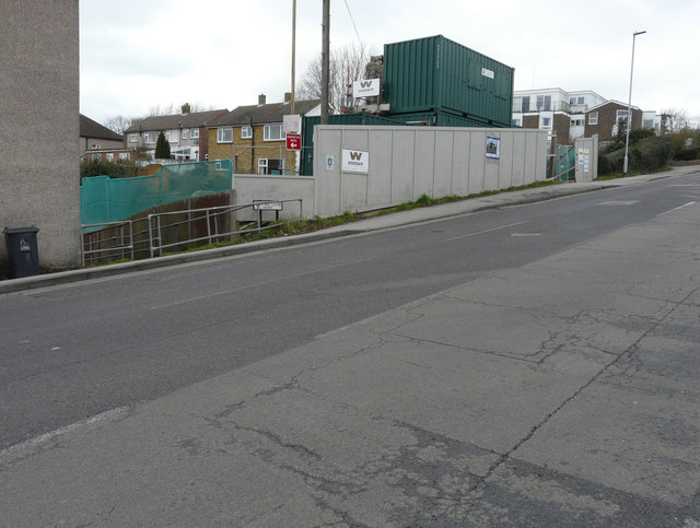
Image: © John Baker Taken: 19 Feb 2017
Planning permission was granted by Canterbury City Council under application number CA//15/01389 for the “demolition of the existing fire damaged building and the erection of a new building, comprising student accommodation, chaplaincy accommodation, lounge and chapel”. Almost all the building has been demolished, other than a small section of wall between the electricity pole and shipping container. This is Image before it was demolished.
Images are licensed for reuse under creativecommons.org/licenses/by-sa/2.0
Image Location
Latitude
51.290095
Longitude
1.060602