Village hall at Green Hammerton
Introduction
The photograph on this page of Village hall at Green Hammerton by Trevor Littlewood as part of the Geograph project.
The Geograph project started in 2005 with the aim of publishing, organising and preserving representative images for every square kilometre of Great Britain, Ireland and the Isle of Man.

There are currently over 7.5m images from over 14,400 individuals and you can help contribute to the project by visiting https://www.geograph.org.uk
Village hall at Green Hammerton
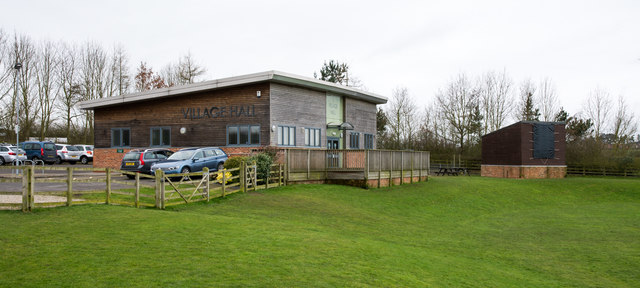
Image: © Trevor Littlewood Taken: 5 Mar 2017
The hall was opened in 2010 and at the time of writing, (March 2017), does not appear at all scales on OS mapping. It lies to the west of the village and overlooks playing fields. It must act as a cricket pavilion - the smaller building will be the scoreboard.
Images are licensed for reuse under creativecommons.org/licenses/by-sa/2.0
Image Location
Latitude
54.005214
Longitude
-1.304998