Calanais/Callanish XV, Circebost, Great Bernera/Be?rnaraigh
Introduction
The photograph on this page of Calanais/Callanish XV, Circebost, Great Bernera/Be?rnaraigh by Claire Pegrum as part of the Geograph project.
The Geograph project started in 2005 with the aim of publishing, organising and preserving representative images for every square kilometre of Great Britain, Ireland and the Isle of Man.

There are currently over 7.5m images from over 14,400 individuals and you can help contribute to the project by visiting https://www.geograph.org.uk
Calanais/Callanish XV, Circebost, Great Bernera/Be?rnaraigh
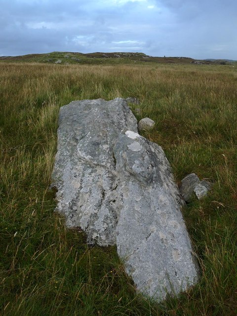
Image: © Claire Pegrum Taken: 2 Sep 2016
From Discovery and Excavation in Scotland, 1976: "On grassy ridge 100m N of road, 25m E of track through Croft 24, Kirkibost. A large prone slab approx. 3.55m x 1.35m, thickness varying from 0.25-0.45m, lying in peat on a grassy ridge. The lower end appears to be surrounded by packing stones and there is a void under the centre of the stone. This stone was brought to our notice by Mr Norman MacDonald of Kirkibost."
Images are licensed for reuse under creativecommons.org/licenses/by-sa/2.0
Image Location
Latitude
58.209404
Longitude
-6.807193