Chapel-en-le-Frith War Memorial
Introduction
The photograph on this page of Chapel-en-le-Frith War Memorial by Gerald England as part of the Geograph project.
The Geograph project started in 2005 with the aim of publishing, organising and preserving representative images for every square kilometre of Great Britain, Ireland and the Isle of Man.

There are currently over 7.5m images from over 14,400 individuals and you can help contribute to the project by visiting https://www.geograph.org.uk
Chapel-en-le-Frith War Memorial
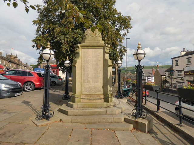
Image: © Gerald England Taken: 16 Sep 2016
Situated on the Market Place, unlike the majority of war memorials, it lists all those who served in WWI, not just those killed. Inscribed around the domed top – commencing above the south face: Erected 1919 to record the honoured names of the men from the Parish of Chapel-en-le-Frith who served in the Great War. THIS MEMORIAL ERECTED BY PUBLIC SUBSCRIPTION WAS DEDICATED BY BRIGADIER GENERAL GODFREY D. GOODMAN. C.M.G., D.S.O., V.D. WHO COMMANDED THE 6TH BATTALION SHERWOOD FORESTERS AND 52nd AND 21st INFANTRY BRIGADES. 5th JULY 1919. The War Memorial which is Grade II listed https://www.britishlistedbuildings.co.uk/en-82023-war-memorial-chapel-en-le-frith-derbyshir was restored in 2011 with the names of men from WWII added. More details including a list of names can be found on the former Parish Council http://web.archive.org/web/20120904025841/http://www.chapel-en-le-frithparishcouncil.gov.uk/warmemorial.htm
Images are licensed for reuse under creativecommons.org/licenses/by-sa/2.0
Image Location


Leaflet Map data © OpenStreetMap
Latitude
53.323193
Longitude
-1.915739