Former gatehouse to Carlisle Canal Basin
Introduction
The photograph on this page of Former gatehouse to Carlisle Canal Basin by Rose and Trev Clough as part of the Geograph project.
The Geograph project started in 2005 with the aim of publishing, organising and preserving representative images for every square kilometre of Great Britain, Ireland and the Isle of Man.

There are currently over 7.5m images from over 14,400 individuals and you can help contribute to the project by visiting https://www.geograph.org.uk
Former gatehouse to Carlisle Canal Basin
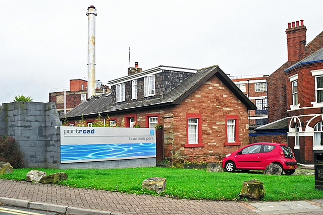
Image: © Rose and Trev Clough Taken: 9 Oct 2011
The Carlisle Canal ran from here to Port Carlisle http://www.geograph.org.uk/photo/933220 . It was only open for 30 years (1823-1853), then it was filled in to become a railway line. For history, see http://www.canalroutes.net/Carlisle-Canal.html . Some of the original buildings at the canal basin, including the bonded warehouse and customs house, survived until the mid 1970s-early 1980s. The Port Road Business Park was created on the site, and now only the gatehouse remains. McVitie's (formerly Carr's) biscuit factory is behind the house, with the Jovial Sailor pub on the right.
Images are licensed for reuse under creativecommons.org/licenses/by-sa/2.0
Image Location
Latitude
54.894198
Longitude
-2.950893