High Cross Monument (Detail)
Introduction
The photograph on this page of High Cross Monument (Detail) by Terry Roberts as part of the Geograph project.
The Geograph project started in 2005 with the aim of publishing, organising and preserving representative images for every square kilometre of Great Britain, Ireland and the Isle of Man.

There are currently over 7.5m images from over 14,400 individuals and you can help contribute to the project by visiting https://www.geograph.org.uk
High Cross Monument (Detail)
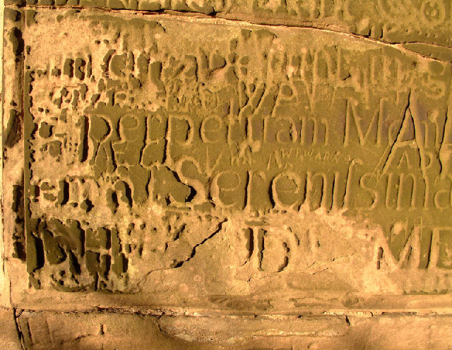
Image: © Terry Roberts Taken: 12 Sep 2005
Situated at the junction of Watling Street and the Fosse Way, the High Cross was erected in 1712. This is a detail of one of the two Latin inscriptions on the base. The Cross itself was destroyed by lightning.
Images are licensed for reuse under creativecommons.org/licenses/by-sa/2.0
Image Location


Leaflet Map data © OpenStreetMap
Latitude
52.492351
Longitude
-1.301834