Balloon Centre Number 11
Introduction
The photograph on this page of Balloon Centre Number 11 by Neil Owen as part of the Geograph project.
The Geograph project started in 2005 with the aim of publishing, organising and preserving representative images for every square kilometre of Great Britain, Ireland and the Isle of Man.

There are currently over 7.5m images from over 14,400 individuals and you can help contribute to the project by visiting https://www.geograph.org.uk
Balloon Centre Number 11
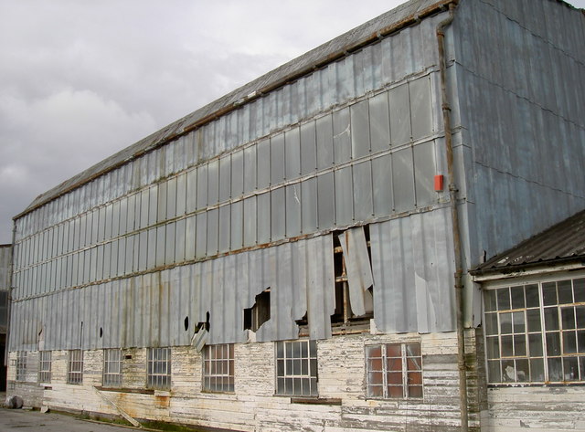
Image: © Neil Owen Taken: 16 Feb 2017
Pucklechurch was a prime site in the preparations for the outbreak of WWII. After tentative trials the need for a defensive system using balloons to protect vital installations was revived and improved at Cardington in Befordshire. By 1939, a national network was formed to base the balloons around; Pucklechurch was Number 11. This hangar was built with mansard-like roofs and large windows high in the walls on three sides. The lower workshops are clad in horizontal timber boards and have multi-pane steel-frame windows and dormers. However, these days the old sheds are part of the Pucklechurch Trading Estate, and have had various occupants. A fire in the adjoining unit has brought it to an uncertain point in its history. Grade II listed. See Image] for more.
Images are licensed for reuse under creativecommons.org/licenses/by-sa/2.0
Image Location
Latitude
51.481871
Longitude
-2.43643