The ?River Annan? from West Street bridge
Introduction
The photograph on this page of The ?River Annan? from West Street bridge by Neil Owen as part of the Geograph project.
The Geograph project started in 2005 with the aim of publishing, organising and preserving representative images for every square kilometre of Great Britain, Ireland and the Isle of Man.

There are currently over 7.5m images from over 14,400 individuals and you can help contribute to the project by visiting https://www.geograph.org.uk
The ?River Annan? from West Street bridge
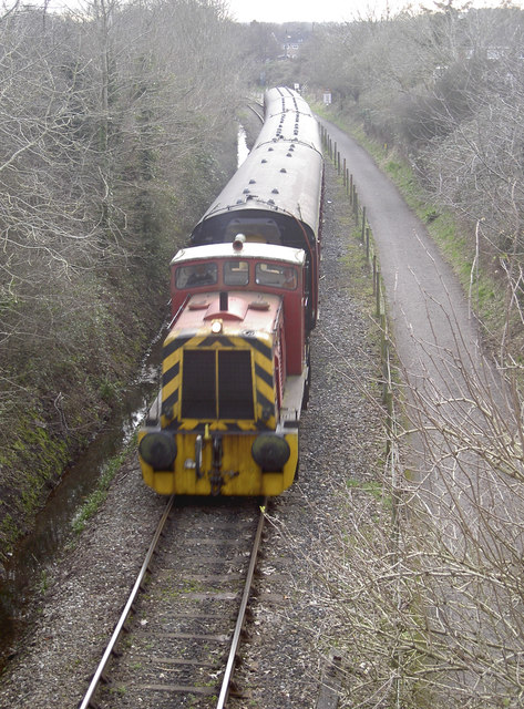
Image: © Neil Owen Taken: 16 Feb 2017
The Avon Valley Railway has the run of the track along Oldland, albeit with just the three stations. Below the bridge is “River Annan” and is, according to the website: 'Ruston Hornsby 0-6-0DH NO.429 Pre TOPS number: 429 ‘River Annan’/’Salty’ Builder/Number: Ruston Hornsby (466618) Built: 1961 This is a Ruston Hornsby LSSH 0-6-0DH (diesel hydraulic) shunting engine. Powered by a 275 hp Paxman 6RPHL 29-litre V6 engine, Twin Disc torque convertor and two-speed final drive, the LSSH is a capable short wheel base shunter, capable of handling heavy trains over short distances and tight curves.'
Images are licensed for reuse under creativecommons.org/licenses/by-sa/2.0
Image Location


Leaflet Map data © OpenStreetMap
Latitude
51.440191
Longitude
-2.472432