Kew Green pond
Introduction
The photograph on this page of Kew Green pond by Michael Dibb as part of the Geograph project.
The Geograph project started in 2005 with the aim of publishing, organising and preserving representative images for every square kilometre of Great Britain, Ireland and the Isle of Man.

There are currently over 7.5m images from over 14,400 individuals and you can help contribute to the project by visiting https://www.geograph.org.uk
Kew Green pond
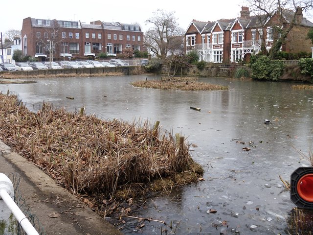
Image: © Michael Dibb Taken: 26 Jan 2017
Mostly frozen over on this bitterly cold January day. Richmond Council's website (http://www.richmond.gov.uk ) describes the pond: 'Originally thought to have been a natural pond fed from a creek of the tidal Thames, Kew pond now has no natural inflow. During high (spring) tides sluice gates are opened to allow river water to fill the pond via an underground channel. The pond is located to the northeast of Kew Green. It is concreted, rectangular in shape and contains important reedbed habitat which is vital for conservation and resident water birds. The pond is managed in partnership with the Friends of Kew Pond.'
Images are licensed for reuse under creativecommons.org/licenses/by-sa/2.0
Image Location
Latitude
51.484631
Longitude
-0.285418