Newcastle-under-Lyme: 19th-century milepost
Introduction
The photograph on this page of Newcastle-under-Lyme: 19th-century milepost by Jonathan Hutchins as part of the Geograph project.
The Geograph project started in 2005 with the aim of publishing, organising and preserving representative images for every square kilometre of Great Britain, Ireland and the Isle of Man.

There are currently over 7.5m images from over 14,400 individuals and you can help contribute to the project by visiting https://www.geograph.org.uk
Newcastle-under-Lyme: 19th-century milepost
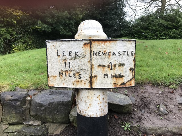
Image: © Jonathan Hutchins Taken: 11 Feb 2017
A good example of a C19 milepost, illustrating the standardisation of roads and the introduction of turnpikes to facilitate the transport needs of the increasingly industrial landscape of C19 Staffordshire. This cast iron milepost is set in its original location, and is intact. The milepost is Grade II listed.
Images are licensed for reuse under creativecommons.org/licenses/by-sa/2.0
Image Location
Latitude
53.015373
Longitude
-2.215391