Plotting fallout
Introduction
The photograph on this page of Plotting fallout by DS Pugh as part of the Geograph project.
The Geograph project started in 2005 with the aim of publishing, organising and preserving representative images for every square kilometre of Great Britain, Ireland and the Isle of Man.

There are currently over 7.5m images from over 14,400 individuals and you can help contribute to the project by visiting https://www.geograph.org.uk
Plotting fallout
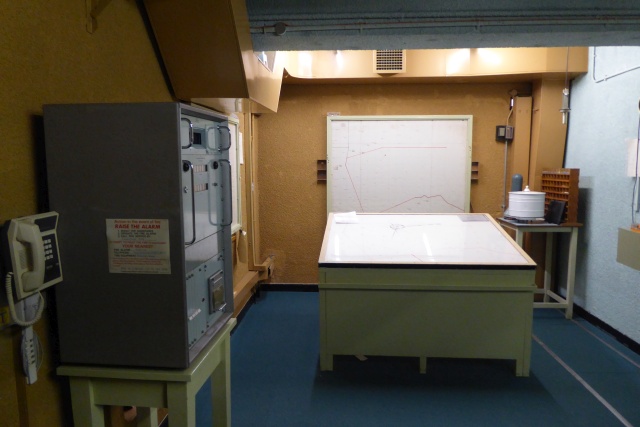
Image: © DS Pugh Taken: 22 Jan 2017
Inside the York Cold War Bunker, former home of No 20 Group Royal Observer Corps Headquarters. On the left is AWDREY (see https://en.wikipedia.org/wiki/Atomic_Weapons_Detection_Recognition_and_Estimation_of_Yield ) and ahead a plotting table to calculate the centre of an atomic attack.
Images are licensed for reuse under creativecommons.org/licenses/by-sa/2.0
Image Location
Latitude
53.956793
Longitude
-1.116982