Raised granary
Introduction
The photograph on this page of Raised granary by Michael Dibb as part of the Geograph project.
The Geograph project started in 2005 with the aim of publishing, organising and preserving representative images for every square kilometre of Great Britain, Ireland and the Isle of Man.

There are currently over 7.5m images from over 14,400 individuals and you can help contribute to the project by visiting https://www.geograph.org.uk
Raised granary
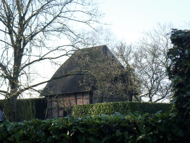
Image: © Michael Dibb Taken: 21 Jan 2017
Seen from the road this granary raised up on staddle stones at Hilcott Farm is probably 18th century. Listed, grade II, with details at: https://www.historicengland.org.uk/listing/the-list/list-entry/1033928
Images are licensed for reuse under creativecommons.org/licenses/by-sa/2.0
Image Location
Latitude
51.323152
Longitude
-1.838362