Former toll house, Swalwell
Introduction
The photograph on this page of Former toll house, Swalwell by Robert Graham as part of the Geograph project.
The Geograph project started in 2005 with the aim of publishing, organising and preserving representative images for every square kilometre of Great Britain, Ireland and the Isle of Man.

There are currently over 7.5m images from over 14,400 individuals and you can help contribute to the project by visiting https://www.geograph.org.uk
Former toll house, Swalwell
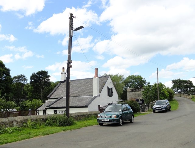
Image: © Robert Graham Taken: 22 Jun 2016
This cottage is beside the River Derwent at Swalwell, beside the old bridge which once carried the Gateshead to Hexham turnpike road over the river. It can be seen on the right. The cottage has a date of 1760 on it. The road is no longer used as there is a new bridge a short distance upstream.
Images are licensed for reuse under creativecommons.org/licenses/by-sa/2.0
Image Location
Latitude
54.955131
Longitude
-1.69142