WWII Hampshire - Ringwood Stop Line, Avon Valley - Fordingbridge anti-tank island (13)
Introduction
The photograph on this page of WWII Hampshire - Ringwood Stop Line, Avon Valley - Fordingbridge anti-tank island (13) by Mike Searle as part of the Geograph project.
The Geograph project started in 2005 with the aim of publishing, organising and preserving representative images for every square kilometre of Great Britain, Ireland and the Isle of Man.

There are currently over 7.5m images from over 14,400 individuals and you can help contribute to the project by visiting https://www.geograph.org.uk
WWII Hampshire - Ringwood Stop Line, Avon Valley - Fordingbridge anti-tank island (13)
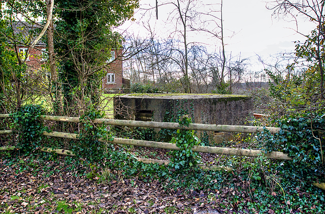
Image: © Mike Searle Taken: 14 Jan 2017
- Flaxfields End pillbox type FW3/22: DoB ID: S0012674 In a corner of a children's recreation ground is a pillbox sited between two roads, one minor through Rockbourne and onwards to the main Blandford to Salisbury road, the other along the B3078 to Cranborne. There once would have been unobstructed views of open ground to the west and to the south. Image
Images are licensed for reuse under creativecommons.org/licenses/by-sa/2.0
Image Location
Latitude
50.92609
Longitude
-1.797909