Townsend: footpath K45 reaches Holdenhurst Village Road
Introduction
The photograph on this page of Townsend: footpath K45 reaches Holdenhurst Village Road by Chris Downer as part of the Geograph project.
The Geograph project started in 2005 with the aim of publishing, organising and preserving representative images for every square kilometre of Great Britain, Ireland and the Isle of Man.

There are currently over 7.5m images from over 14,400 individuals and you can help contribute to the project by visiting https://www.geograph.org.uk
Townsend: footpath K45 reaches Holdenhurst Village Road
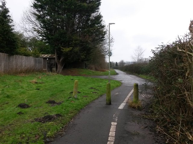
Image: © Chris Downer Taken: 8 Jan 2017
This public footpath, nowadays marked out as a shared foot/cycle route, runs for 500m or so alongside the main A338 and is essentially a replacement for this segment of Holdenhurst Road, which was lost to make way for the dual carriageway. Holdenhurst Road is still one of the town's main routes but no longer reaches Holdenhurst village as it originally did. Here, we look along the path at its eastern end, where the original Holdenhurst Road recommences ahead, now called Holdenhurst Village Road in these days of satnavs to avoid confusion with the main segment in town. With the slight change in direction, one can visualise the old road continuing just to our right, where the present-day A338 now runs just over the hedge. See Image for the view along the path from just ahead, with links to further photos along the route.
Images are licensed for reuse under creativecommons.org/licenses/by-sa/2.0
Image Location
Latitude
50.751314
Longitude
-1.821341