Tuckton: graffiti on footpath I23
Introduction
The photograph on this page of Tuckton: graffiti on footpath I23 by Chris Downer as part of the Geograph project.
The Geograph project started in 2005 with the aim of publishing, organising and preserving representative images for every square kilometre of Great Britain, Ireland and the Isle of Man.

There are currently over 7.5m images from over 14,400 individuals and you can help contribute to the project by visiting https://www.geograph.org.uk
Tuckton: graffiti on footpath I23
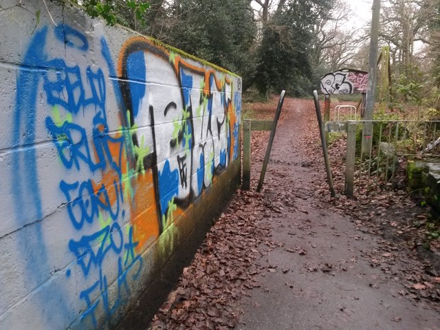
Image: © Chris Downer Taken: 8 Jan 2017
This public footpath comes up from Iford Lane (behind us) into The Rookery, a wooded public space. The course of the public right of way turns left immediately beyond the wall, bound for Northey Road. The path ahead, though not designated a right of way, is also available and leads to Beaufort Road. Graffiti adorns not only the wall on the left, but also the sign welcoming us to The Rookery, to the right just beyond the telegraph pole. See Image for the next view on the path behind us, and Image for the next view ahead, with links to further photos along the public footpath.
Images are licensed for reuse under creativecommons.org/licenses/by-sa/2.0
Image Location
Latitude
50.735813
Longitude
-1.80057