Toothill Lane, Mansfield, Notts.
Introduction
The photograph on this page of Toothill Lane, Mansfield, Notts. by David Hallam-Jones as part of the Geograph project.
The Geograph project started in 2005 with the aim of publishing, organising and preserving representative images for every square kilometre of Great Britain, Ireland and the Isle of Man.

There are currently over 7.5m images from over 14,400 individuals and you can help contribute to the project by visiting https://www.geograph.org.uk
Toothill Lane, Mansfield, Notts.
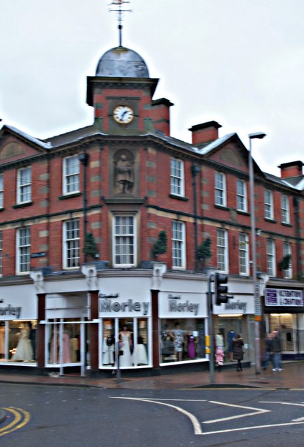
Image: © David Hallam-Jones Taken: 7 Jan 2017
The Brunts Charity, Mansfield was established as the result of a bequest of Samuel Brunt's in 1711. The charity's office is based here at the corner of Toothill Lane and Leeming Street in the town centre. The trust is managed by eleven Trustees from the Mansfield area and it provides over 150 almshouse properties within three town centre locations.
Images are licensed for reuse under creativecommons.org/licenses/by-sa/2.0
Image Location
Latitude
53.145403
Longitude
-1.195158