St Mary, Nantwich: west end
Introduction
The photograph on this page of St Mary, Nantwich: west end by Stephen Craven as part of the Geograph project.
The Geograph project started in 2005 with the aim of publishing, organising and preserving representative images for every square kilometre of Great Britain, Ireland and the Isle of Man.

There are currently over 7.5m images from over 14,400 individuals and you can help contribute to the project by visiting https://www.geograph.org.uk
St Mary, Nantwich: west end
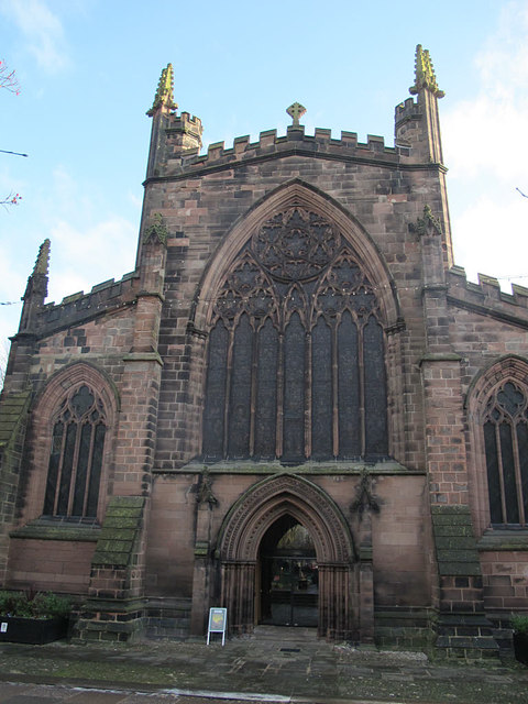
Image: © Stephen Craven Taken: 30 Dec 2016
The west end of the church shows the red sandstone from which it is built, which apparently came from a quarry near the Dee estuary. The west doors are now kept permanently open, with an inner glazed screen giving views into the church.
Images are licensed for reuse under creativecommons.org/licenses/by-sa/2.0
Image Location
Latitude
53.066977
Longitude
-2.521089