Royal Oak House, Gaitsgill
Introduction
The photograph on this page of Royal Oak House, Gaitsgill by Rose and Trev Clough as part of the Geograph project.
The Geograph project started in 2005 with the aim of publishing, organising and preserving representative images for every square kilometre of Great Britain, Ireland and the Isle of Man.

There are currently over 7.5m images from over 14,400 individuals and you can help contribute to the project by visiting https://www.geograph.org.uk
Royal Oak House, Gaitsgill
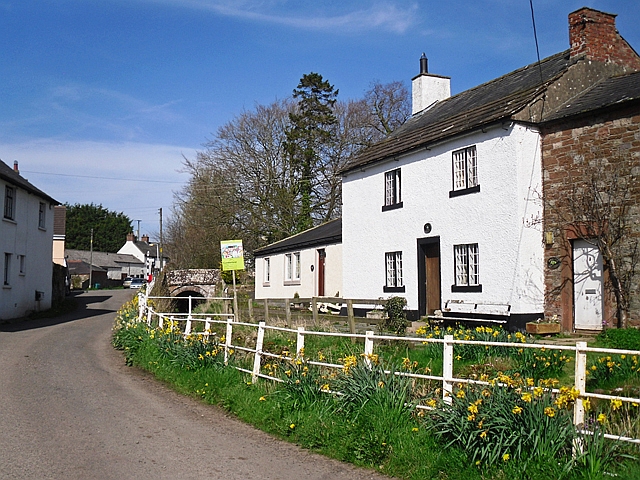
Image: © Rose and Trev Clough Taken: 21 Apr 2016
The two storey white house used to be a pub called the Royal Oak. Don't know when it closed, but seems to have been still a pub in 1984, when it and the adjoining cottage (rt) were given listed building status http://www.britishlistedbuildings.co.uk/en-78316-royal-oak-and-adjoining-house-dalston-cum#.WFhmp33Dsrg . The Pen Beck runs between the houses and the road.
Images are licensed for reuse under creativecommons.org/licenses/by-sa/2.0
Image Location
Latitude
54.811498
Longitude
-2.953617