Old GPO telephone cable marker (2), close up
Introduction
The photograph on this page of Old GPO telephone cable marker (2), close up by Rose and Trev Clough as part of the Geograph project.
The Geograph project started in 2005 with the aim of publishing, organising and preserving representative images for every square kilometre of Great Britain, Ireland and the Isle of Man.

There are currently over 7.5m images from over 14,400 individuals and you can help contribute to the project by visiting https://www.geograph.org.uk
Old GPO telephone cable marker (2), close up
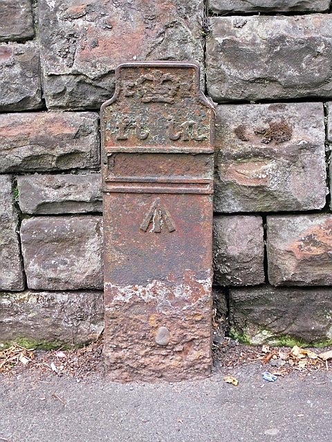
Image: © Rose and Trev Clough Taken: 11 Aug 2015
For location, see Image . At the top of the cast iron post is a crown and the initials ER - pretty sure this dates it to the reign of Edward VII (1901-1910). Originally there would have been numbers attached showing the distance in feet and inches to a buried telephone cable or junction. The arrow symbol was an official identifier of government property. At the time this was installed much of the telephone network in the UK, including all trunk lines, was run by the General Post Office http://www.britishtelephones.com/histuk.htm . Later cable markers (made of concrete) had 'GPO' stamped upon them - see Image .
Images are licensed for reuse under creativecommons.org/licenses/by-sa/2.0
Image Location
Latitude
54.885276
Longitude
-2.919038