Southern boundary of Trevethin, Torfaen
Introduction
The photograph on this page of Southern boundary of Trevethin, Torfaen by Jaggery as part of the Geograph project.
The Geograph project started in 2005 with the aim of publishing, organising and preserving representative images for every square kilometre of Great Britain, Ireland and the Isle of Man.

There are currently over 7.5m images from over 14,400 individuals and you can help contribute to the project by visiting https://www.geograph.org.uk
Southern boundary of Trevethin, Torfaen
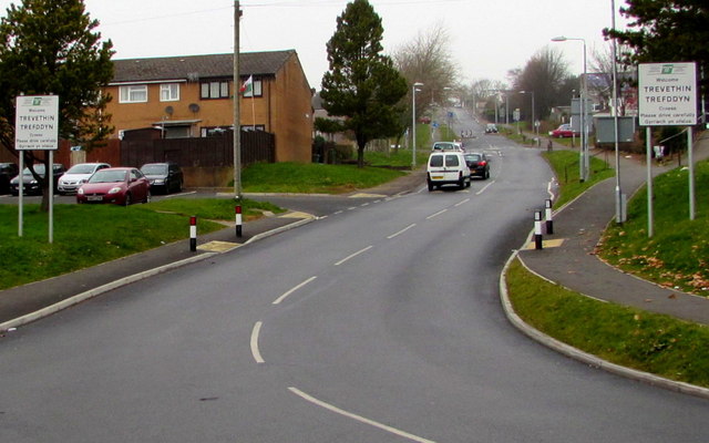
Image: © Jaggery Taken: 5 Dec 2016
The boundary signs facing the southern end of Church Avenue show that Trevethin is Trefddyn in Welsh. Formerly a small village that was the seat of the parish of Trevethin in the ancient Abergavenny Hundred, Trevethin is now a suburb in the north of Pontypool. Trevethin's population was 5,147 on the day of UK National Census in April 2011.
Images are licensed for reuse under creativecommons.org/licenses/by-sa/2.0
Image Location
Latitude
51.712488
Longitude
-3.039457