Disused school building, Moat Street
Introduction
The photograph on this page of Disused school building, Moat Street by Rose and Trev Clough as part of the Geograph project.
The Geograph project started in 2005 with the aim of publishing, organising and preserving representative images for every square kilometre of Great Britain, Ireland and the Isle of Man.

There are currently over 7.5m images from over 14,400 individuals and you can help contribute to the project by visiting https://www.geograph.org.uk
Disused school building, Moat Street
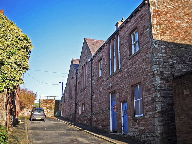
Image: © Rose and Trev Clough Taken: 23 Nov 2016
Built in 1856 for an expanding National School, it became a Board School in the 1870s and was enlarged to accommodate 600 pupils (Bulmer's Directory 1901 http://www.stevebulman.f9.co.uk/cumbria/1901/brampton1901_f.html ). In the earlier 20th century it was a through school, with children starting as infants and leaving at about 14. When Brampton Junior School moved to new buildings nearby in around 1960, the Infant School remained at Moat Street. In 2008 the two schools were merged, and this site was vacated shortly afterwards.
Images are licensed for reuse under creativecommons.org/licenses/by-sa/2.0
Image Location
Latitude
54.944056
Longitude
-2.73289