Track leading to Camp Hill Clump
Introduction
The photograph on this page of Track leading to Camp Hill Clump by Marathon as part of the Geograph project.
The Geograph project started in 2005 with the aim of publishing, organising and preserving representative images for every square kilometre of Great Britain, Ireland and the Isle of Man.

There are currently over 7.5m images from over 14,400 individuals and you can help contribute to the project by visiting https://www.geograph.org.uk
Track leading to Camp Hill Clump
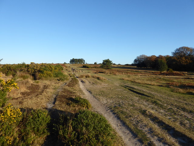
Image: © Marathon Taken: 4 Dec 2016
Ashdown Forest is a former medieval hunting forest, and is the highest ridge of the High Weald. At ten square miles it is the largest open access area in the South East. Ashdown Forest was purchased by East Sussex County Council from the De La Warr family in 1988. It is now managed by a Board of Conservators. Nearly two thirds of it is heathland. One of the characteristics of the forest are isolated clumps of trees. Camp Hill Clump can be seen on the horizon. It was first planted in 1825. Its name probably derives from a military camp nearby. This is the track from Ellison's Pond up to Camp Hill.
Images are licensed for reuse under creativecommons.org/licenses/by-sa/2.0
Image Location
Latitude
51.040734
Longitude
0.091142