Point Bridge, Paddington
Introduction
The photograph on this page of Point Bridge, Paddington by Oliver Dixon as part of the Geograph project.
The Geograph project started in 2005 with the aim of publishing, organising and preserving representative images for every square kilometre of Great Britain, Ireland and the Isle of Man.

There are currently over 7.5m images from over 14,400 individuals and you can help contribute to the project by visiting https://www.geograph.org.uk
Point Bridge, Paddington
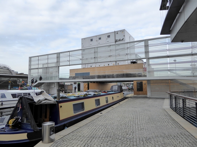
Image: © Oliver Dixon Taken: 23 Nov 2016
Point Bridge spans the Paddington Basin and provides a pedestrian link between North Wharf Road (to the right) and Paddington Station. The approach from North Wharf Road is via a ramp, from the station via a lift or steps. The significance of the bridge superstructure is unclear. Beyond the bridge is the temporary bridge supporting a bank of site cabins Image in conjunction with the construction of the adjacent Brunel Building.
Images are licensed for reuse under creativecommons.org/licenses/by-sa/2.0
Image Location
Latitude
51.518247
Longitude
-0.177064