View east off Westminster Bridge
Introduction
The photograph on this page of View east off Westminster Bridge by Christopher Hilton as part of the Geograph project.
The Geograph project started in 2005 with the aim of publishing, organising and preserving representative images for every square kilometre of Great Britain, Ireland and the Isle of Man.

There are currently over 7.5m images from over 14,400 individuals and you can help contribute to the project by visiting https://www.geograph.org.uk
View east off Westminster Bridge
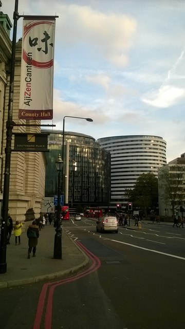
Image: © Christopher Hilton Taken: 3 Nov 2016
On the extreme left of the photo, County Hall: in the centre, the hotel that replaced County Hall's much-loathed Island Block after the abolition of the Inner London Education Authority in 1990. Squeezing into the right-hand side of the picture, St Thomas's Hospital. For a similar view in 1989, see Image
Images are licensed for reuse under creativecommons.org/licenses/by-sa/2.0
Image Location
Latitude
51.500666
Longitude
-0.117252