The Old Vicarage, Buckminster
Introduction
The photograph on this page of The Old Vicarage, Buckminster by Alan Murray-Rust as part of the Geograph project.
The Geograph project started in 2005 with the aim of publishing, organising and preserving representative images for every square kilometre of Great Britain, Ireland and the Isle of Man.

There are currently over 7.5m images from over 14,400 individuals and you can help contribute to the project by visiting https://www.geograph.org.uk
The Old Vicarage, Buckminster
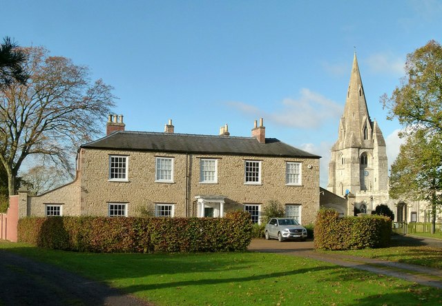
Image: © Alan Murray-Rust Taken: 7 Nov 2016
An early 19th house of coursed limestone rubble with hipped slate roof, Listed Grade II. The impressive spire of the church in the background.
Images are licensed for reuse under creativecommons.org/licenses/by-sa/2.0
Image Location
Latitude
52.797766
Longitude
-0.697305