Quiet flows the Don - Brightside Weir
Introduction
The photograph on this page of Quiet flows the Don - Brightside Weir by Alan Murray-Rust as part of the Geograph project.
The Geograph project started in 2005 with the aim of publishing, organising and preserving representative images for every square kilometre of Great Britain, Ireland and the Isle of Man.

There are currently over 7.5m images from over 14,400 individuals and you can help contribute to the project by visiting https://www.geograph.org.uk
Quiet flows the Don - Brightside Weir
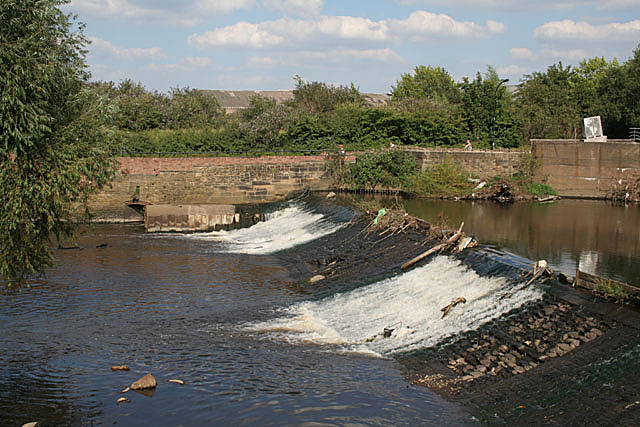
Image: © Alan Murray-Rust Taken: 5 Aug 2007
This was not so true just a few weeks earlier when the river reached exceptional levels. Judging from debris, the water was at least as high as the light/dark division on the concrete at the right hand side of the picture. Brightside Weir was one of the earliest weirs built to provide water power for the early steel industry in Sheffield.
Images are licensed for reuse under creativecommons.org/licenses/by-sa/2.0
Image Location


Leaflet Map data © OpenStreetMap
Latitude
53.406393
Longitude
-1.418885