Red Hill Near Rolls Farm
Introduction
The photograph on this page of Red Hill Near Rolls Farm by Glyn Baker as part of the Geograph project.
The Geograph project started in 2005 with the aim of publishing, organising and preserving representative images for every square kilometre of Great Britain, Ireland and the Isle of Man.

There are currently over 7.5m images from over 14,400 individuals and you can help contribute to the project by visiting https://www.geograph.org.uk
Red Hill Near Rolls Farm
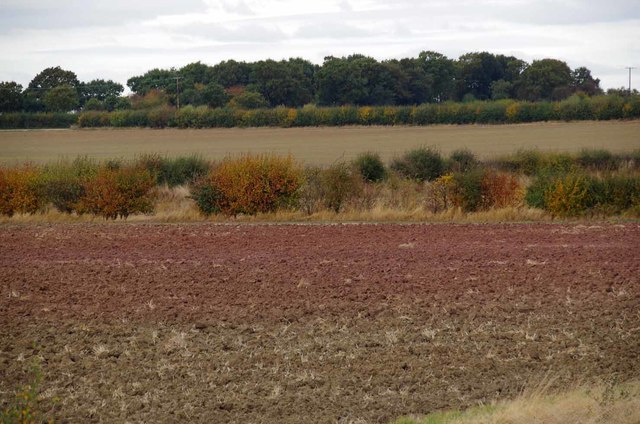
Image: © Glyn Baker Taken: 28 Oct 2016
Not much of a hill but very plainly red. This clearly visible surface archaeology is a Red Hill. Red Hills were Roman salt pans https://en.wikipedia.org/wiki/Red_hill_(salt_making) , the redness was caused by burning the heat being used to evaporate away the water. 2000 years later salt is still extracted from the Blackwater by the Image
Images are licensed for reuse under creativecommons.org/licenses/by-sa/2.0
Image Location
Latitude
51.74186
Longitude
0.82072