Godstone Place
Introduction
The photograph on this page of Godstone Place by Ian Capper as part of the Geograph project.
The Geograph project started in 2005 with the aim of publishing, organising and preserving representative images for every square kilometre of Great Britain, Ireland and the Isle of Man.

There are currently over 7.5m images from over 14,400 individuals and you can help contribute to the project by visiting https://www.geograph.org.uk
Godstone Place
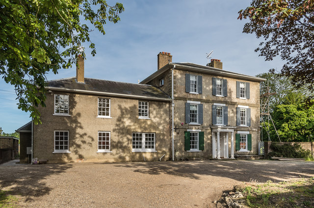
Image: © Ian Capper Taken: 6 Jun 2014
Late 18th Century house with 19th Century front and extension. Recently refurbished. Grade II listed - see https://historicengland.org.uk/listing/the-list/list-entry/1377627.
Images are licensed for reuse under creativecommons.org/licenses/by-sa/2.0
Image Location
Latitude
51.248655
Longitude
-0.066578