Railway line from Hildesheim Bridge
Introduction
The photograph on this page of Railway line from Hildesheim Bridge by Derek Harper as part of the Geograph project.
The Geograph project started in 2005 with the aim of publishing, organising and preserving representative images for every square kilometre of Great Britain, Ireland and the Isle of Man.

There are currently over 7.5m images from over 14,400 individuals and you can help contribute to the project by visiting https://www.geograph.org.uk
Railway line from Hildesheim Bridge
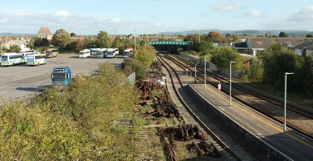
Image: © Derek Harper Taken: 18 Oct 2016
With the eastern end of a platform. On the left is the coach section of the Locking Road car park. The next (blue) bridge carries the B3440 Drove Road. The tall building on the left is the redundant St Saviour's Church, now St Saviour's Hall, attached, as it were, to All Saints Church.
Images are licensed for reuse under creativecommons.org/licenses/by-sa/2.0
Image Location
Latitude
51.344882
Longitude
-2.968659