Bitterne Triangle
Introduction
The photograph on this page of Bitterne Triangle by Bill Boaden as part of the Geograph project.
The Geograph project started in 2005 with the aim of publishing, organising and preserving representative images for every square kilometre of Great Britain, Ireland and the Isle of Man.

There are currently over 7.5m images from over 14,400 individuals and you can help contribute to the project by visiting https://www.geograph.org.uk
Bitterne Triangle
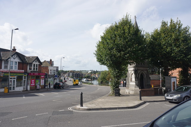
Image: © Bill Boaden Taken: 29 Sep 2016
The Sayers Monument is partly obscured by trees. It was both a clock tower and a fountain and was moved here from central Southampton in 1934. Beyond it, one looks down to Cobden Bridge crossing the Itchen.
Images are licensed for reuse under creativecommons.org/licenses/by-sa/2.0
Image Location
Latitude
50.92433
Longitude
-1.376207