
Radar, Belfast City Airport (October 2016)
Introduction
The photograph on this page of Radar, Belfast City Airport (October 2016) by Albert Bridge as part of the Geograph project.
The Geograph project started in 2005 with the aim of publishing, organising and preserving representative images for every square kilometre of Great Britain, Ireland and the Isle of Man.

There are currently over 7.5m images from over 14,400 individuals and you can help contribute to the project by visiting https://www.geograph.org.uk
Radar, Belfast City Airport (October 2016)
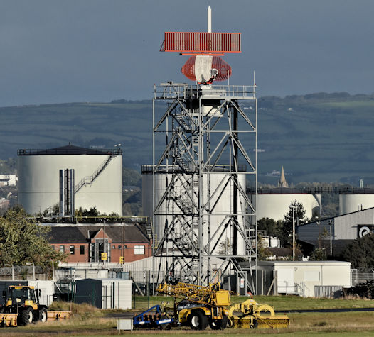
Image: © Albert Bridge Taken: 13 Oct 2016
See http://www.geograph.org.uk/search.php?i=66581568. The City Airport’s air traffic control is now contracted out to NATS https://en.wikipedia.org/wiki/NATS_Holdings. An Airport press release records “Release Date: 14 Jul 2016 It is the first time the airport has awarded a contract for air traffic control services to an external company, with NATS beating bids from Air Navigation Services and the Swedish air traffic control provider, LFV. NATS, which manages air traffic services at 13 other UK airports, will now take responsibility for the safety and efficiency of the airport’s 42,000 annual arrivals and departures, having provided engineering services to the airport since 2007.”
Images are licensed for reuse under creativecommons.org/licenses/by-sa/2.0
Image Location

Latitude
54.615447
Longitude
-5.881934