Christ's Hospital from the air
Introduction
The photograph on this page of Christ's Hospital from the air by Derek Harper as part of the Geograph project.
The Geograph project started in 2005 with the aim of publishing, organising and preserving representative images for every square kilometre of Great Britain, Ireland and the Isle of Man.

There are currently over 7.5m images from over 14,400 individuals and you can help contribute to the project by visiting https://www.geograph.org.uk
Christ's Hospital from the air
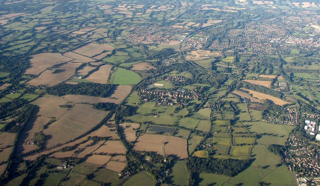
Image: © Derek Harper Taken: 3 Oct 2016
The central row of buildings from left to right is Christ's Hospital School. To the left is an extant and a disused railway line meeting, the latter branching away in the foreground and off to the left beyond the school. The squarish block of woodland across the line from the school is Shelley's Wood. The other principal curving feature is the A24 bypassing Horsham at upper right. The suburb to its left is Broadridge Heath. At lower right is the edge of Southwater.
Images are licensed for reuse under creativecommons.org/licenses/by-sa/2.0
Image Location
Latitude
51.043513
Longitude
-0.365236