Cherry Hinton: Mafeking Cottage
Introduction
The photograph on this page of Cherry Hinton: Mafeking Cottage by John Sutton as part of the Geograph project.
The Geograph project started in 2005 with the aim of publishing, organising and preserving representative images for every square kilometre of Great Britain, Ireland and the Isle of Man.

There are currently over 7.5m images from over 14,400 individuals and you can help contribute to the project by visiting https://www.geograph.org.uk
Cherry Hinton: Mafeking Cottage
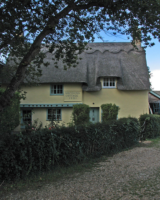
Image: © John Sutton Taken: 10 Oct 2016
Grade II listed, this 16th- and 17th-century timber-framed cottage is much older than its name, which celebrates the Relief of Mafeking in 1901, during the Boer War.
Images are licensed for reuse under creativecommons.org/licenses/by-sa/2.0
Image Location


Leaflet Map data © OpenStreetMap
Latitude
52.195554
Longitude
0.176524