Boundary stone
Introduction
The photograph on this page of Boundary stone by Ian Capper as part of the Geograph project.
The Geograph project started in 2005 with the aim of publishing, organising and preserving representative images for every square kilometre of Great Britain, Ireland and the Isle of Man.

There are currently over 7.5m images from over 14,400 individuals and you can help contribute to the project by visiting https://www.geograph.org.uk
Boundary stone
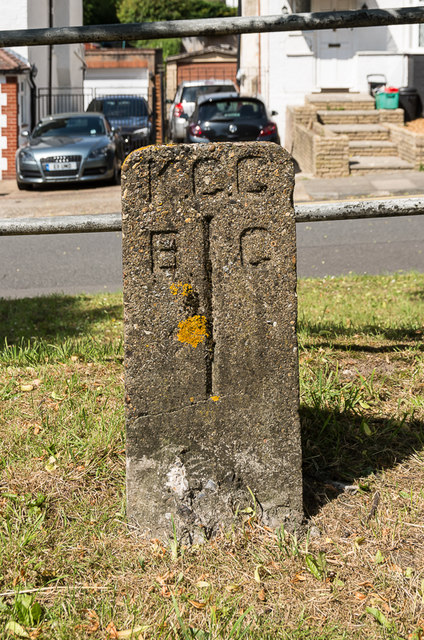
Image: © Ian Capper Taken: 24 Jun 2015
What would seem to be a boundary stone, situated on Spur Road (see Image for wider view). I have not been able to identify what it signifies. "KCC" is almost certainly "Kent County Council" (in which county this area was situated until included in the London Borough of Bromley in 1965). But the meaning of "B" and "C" is a mystery. From old maps there has never been a boundary here, and in the 1920s this would have all been part of the Bromley Rural District, before becoming Orpington Urban District in 1934. The village of Chelsfield lies to the southeast of here, but I can find no evidence of it having reached this far, and even if it did, that would leave the "B" totally unexplained - at this level west of here would unquestionably have been Orpington.
Images are licensed for reuse under creativecommons.org/licenses/by-sa/2.0
Image Location
Latitude
51.373071
Longitude
0.101049