Rose Cottage and 12 - 13 Cotmandene
Introduction
The photograph on this page of Rose Cottage and 12 - 13 Cotmandene by Ian Capper as part of the Geograph project.
The Geograph project started in 2005 with the aim of publishing, organising and preserving representative images for every square kilometre of Great Britain, Ireland and the Isle of Man.

There are currently over 7.5m images from over 14,400 individuals and you can help contribute to the project by visiting https://www.geograph.org.uk
Rose Cottage and 12 - 13 Cotmandene
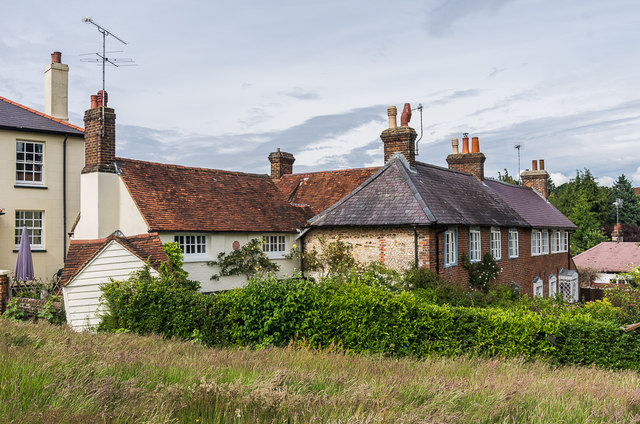
Image: © Ian Capper Taken: 11 Jun 2016
Cottages on the edge of Cotmandene. Rose Cottage, nearer the camera and slightly set back, probably dates from the 18th Century and was once used as a dairy. Nos 12 - 13, beyond, dates from around 1800 but with an earlier timber core. It was once used as a farmhouse. Both are grade II listed - see https://www.historicengland.org.uk/listing/the-list/list-entry/1287614 and https://www.historicengland.org.uk/listing/the-list/list-entry/1378065.
Images are licensed for reuse under creativecommons.org/licenses/by-sa/2.0
Image Location
Latitude
51.232495
Longitude
-0.32629