Water troughs, Duke's Lock
Introduction
The photograph on this page of Water troughs, Duke's Lock by Vieve Forward as part of the Geograph project.
The Geograph project started in 2005 with the aim of publishing, organising and preserving representative images for every square kilometre of Great Britain, Ireland and the Isle of Man.

There are currently over 7.5m images from over 14,400 individuals and you can help contribute to the project by visiting https://www.geograph.org.uk
Water troughs, Duke's Lock
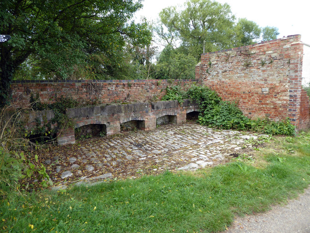
Image: © Vieve Forward Taken: 6 Sep 2016
Water troughs and rings for tying up and resting the horses that drew the narrowboats on the Oxford Canal, near Duke's Lock House. This was possibly covered at one time.
Images are licensed for reuse under creativecommons.org/licenses/by-sa/2.0
Image Location
Latitude
51.792473
Longitude
-1.293985