Weir, River Walkham, Horrabridge
Introduction
The photograph on this page of Weir, River Walkham, Horrabridge by M J Roscoe as part of the Geograph project.
The Geograph project started in 2005 with the aim of publishing, organising and preserving representative images for every square kilometre of Great Britain, Ireland and the Isle of Man.

There are currently over 7.5m images from over 14,400 individuals and you can help contribute to the project by visiting https://www.geograph.org.uk
Weir, River Walkham, Horrabridge
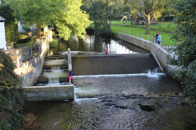
Image: © M J Roscoe Taken: 14 Sep 2016
On the left of the weir there is what appears to be a fish pass next to the former watermill. To the right of the river is Weir Park.
Images are licensed for reuse under creativecommons.org/licenses/by-sa/2.0
Image Location
Latitude
50.509876
Longitude
-4.098097