Rose Hill
Introduction
The photograph on this page of Rose Hill by Ian Capper as part of the Geograph project.
The Geograph project started in 2005 with the aim of publishing, organising and preserving representative images for every square kilometre of Great Britain, Ireland and the Isle of Man.

There are currently over 7.5m images from over 14,400 individuals and you can help contribute to the project by visiting https://www.geograph.org.uk
Rose Hill
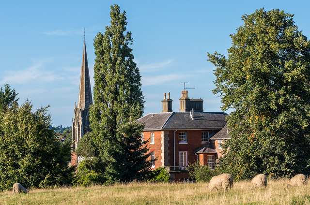
Image: © Ian Capper Taken: 11 Sep 2016
The area of grass on Rose Hill gives rise to the unexpected sight of sheep grazing within a few hundred yards of Dorking High Street. In the background is Holly House, an early 19th Century grade II listed house - see https://www.historicengland.org.uk/listing/the-list/list-entry/1229454. Beyond is the spire of St Martin's Church.
Images are licensed for reuse under creativecommons.org/licenses/by-sa/2.0
Image Location
Latitude
51.230258
Longitude
-0.332086