Wheatcroft House
Introduction
The photograph on this page of Wheatcroft House by Bob Harvey as part of the Geograph project.
The Geograph project started in 2005 with the aim of publishing, organising and preserving representative images for every square kilometre of Great Britain, Ireland and the Isle of Man.

There are currently over 7.5m images from over 14,400 individuals and you can help contribute to the project by visiting https://www.geograph.org.uk
Wheatcroft House
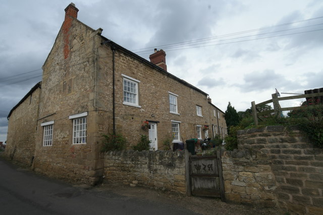
Image: © Bob Harvey Taken: 9 Sep 2016
Built in the 17th century as a house, converted later to two cottages and then extensively rebuilt in the 19th century as a single dwelling, this is a grade II listed building. See https://www.historicengland.org.uk/listing/the-list/list-entry/1192538
Images are licensed for reuse under creativecommons.org/licenses/by-sa/2.0
Image Location
Latitude
53.566822
Longitude
-1.268265