'Holy Well', King Water
Introduction
The photograph on this page of 'Holy Well', King Water by Karl and Ali as part of the Geograph project.
The Geograph project started in 2005 with the aim of publishing, organising and preserving representative images for every square kilometre of Great Britain, Ireland and the Isle of Man.

There are currently over 7.5m images from over 14,400 individuals and you can help contribute to the project by visiting https://www.geograph.org.uk
'Holy Well', King Water
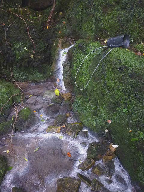
Image: © Karl and Ali Taken: 6 Sep 2016
The 'well' is described as 'sulphureous' on the map but anyone expecting much will probably be disappointed. There is a small seep issuing from a crack with evidence of mineral deposits below it and a slight smell of bad eggs. It is a bit like the mineral spring at Gilsland Image but in a much more remote situation and without the development. Although marked on the map, the spring is quite tricky to find, being close to the river and below a decaying set of stone steps. Anyone fancying 'taking the waters' can take advantage of the tethered metal cup (I chose not to!).
Images are licensed for reuse under creativecommons.org/licenses/by-sa/2.0
Image Location
Latitude
55.007956
Longitude
-2.635863