Defending Dorset in 1940: Blandford anti-tank island - anti-tank ditch (11)
Introduction
The photograph on this page of Defending Dorset in 1940: Blandford anti-tank island - anti-tank ditch (11) by Mike Searle as part of the Geograph project.
The Geograph project started in 2005 with the aim of publishing, organising and preserving representative images for every square kilometre of Great Britain, Ireland and the Isle of Man.

There are currently over 7.5m images from over 14,400 individuals and you can help contribute to the project by visiting https://www.geograph.org.uk
Defending Dorset in 1940: Blandford anti-tank island - anti-tank ditch (11)
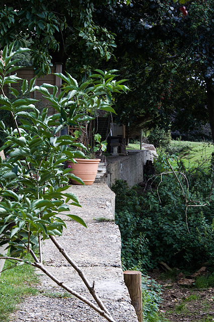
Image: © Mike Searle Taken: 8 Sep 2016
- Anti-tank ditch: DoB ID: S0000125 The view south from the pillbox looking along the top of the reinforced concrete wall of the anti-tank ditch. It was designed to stop any tank that had made it across the river and the heavily mined Crown Meadows. The ditch was created in 1940-41 by utilising the natural features of a deer park's late C18 or early C19 brick and flint ha-ha. The 5' deep ha-ha was converted into an anti-tank ditch by creating a 45 degree slope to its approach, and facing the old flint wall with reinforced concrete. The 280 metre long ditch was covered by a pillbox at each end, one was here at Parklands, the other in the yard of the current BT premises in Shorts Lane. Image
Images are licensed for reuse under creativecommons.org/licenses/by-sa/2.0
Image Location
Latitude
50.857709
Longitude
-2.1693