Former Dudley to Walsall line - beneath Dudley Port
Introduction
The photograph on this page of Former Dudley to Walsall line - beneath Dudley Port by Michael Westley as part of the Geograph project.
The Geograph project started in 2005 with the aim of publishing, organising and preserving representative images for every square kilometre of Great Britain, Ireland and the Isle of Man.

There are currently over 7.5m images from over 14,400 individuals and you can help contribute to the project by visiting https://www.geograph.org.uk
Former Dudley to Walsall line - beneath Dudley Port
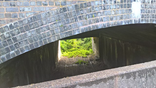
Image: © Michael Westley Taken: 3 Aug 2016
View from footpath, next to Dudley Port station car park. Looking under the mainline and canal, nature takes its course, and still no signs of confidence, 9 years previously Image, that the route may become a tram route between Walsall, Wednesbury and Dudley.
Images are licensed for reuse under creativecommons.org/licenses/by-sa/2.0
Image Location
Latitude
52.524694
Longitude
-2.050364