Bushby Brook downstream
Introduction
The photograph on this page of Bushby Brook downstream by Andrew Tatlow as part of the Geograph project.
The Geograph project started in 2005 with the aim of publishing, organising and preserving representative images for every square kilometre of Great Britain, Ireland and the Isle of Man.

There are currently over 7.5m images from over 14,400 individuals and you can help contribute to the project by visiting https://www.geograph.org.uk
Bushby Brook downstream
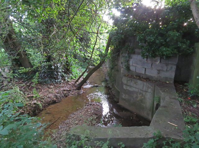
Image: © Andrew Tatlow Taken: 27 Jun 2016
The structure in the foreground is where pipes from the adjacent flood relief basin drain to the brook.The massive wall to the right acts as a flood defence for the houses on the other side. Its foundations look a bit rough and one wonders whether the brook is gradually undercutting them.This stretch of Bushby Brook seems a forgotten and neglected place!
Images are licensed for reuse under creativecommons.org/licenses/by-sa/2.0
Image Location
Latitude
52.637528
Longitude
-1.042696