Pumping station with John Muir Way mural
Introduction
The photograph on this page of Pumping station with John Muir Way mural by Lairich Rig as part of the Geograph project.
The Geograph project started in 2005 with the aim of publishing, organising and preserving representative images for every square kilometre of Great Britain, Ireland and the Isle of Man.

There are currently over 7.5m images from over 14,400 individuals and you can help contribute to the project by visiting https://www.geograph.org.uk
Pumping station with John Muir Way mural
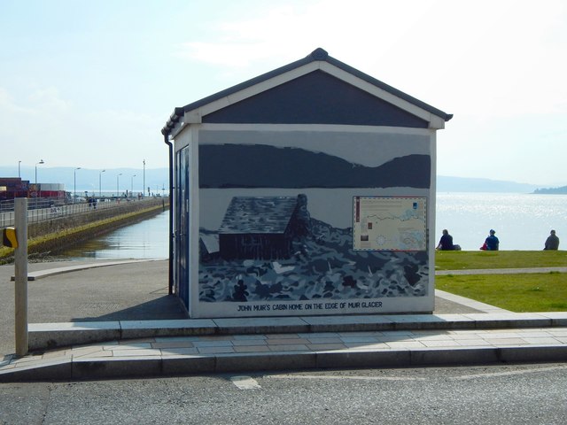
Image: © Lairich Rig Taken: 17 Aug 2016
The John Muir Way now begins here, and, in that connection, an artwork and a seat were installed beside the building, as shown in Image (compare Image, taken before the creation of the John Muir Way). As is clear from those pictures, the building stands beside a pedestrian crossing (see also the far left of the present photograph). The mural shows "John Muir's cabin home on the edge of Muir Glacier"; it has an inset (or, rather, taped-on) map showing the course of the John Muir Way, a 134-mile (215-km) route that starts right here. The same panel also provides some information about an artwork that stands beside this pumping station: Image The path that can be seen crossing the grass just to the right of the pumping station leads to that artwork. Image can be seen on the left.
Images are licensed for reuse under creativecommons.org/licenses/by-sa/2.0
Image Location
Latitude
56.003138
Longitude
-4.736372