The end of the road - for now
Introduction
The photograph on this page of The end of the road - for now by Gordon Hatton as part of the Geograph project.
The Geograph project started in 2005 with the aim of publishing, organising and preserving representative images for every square kilometre of Great Britain, Ireland and the Isle of Man.

There are currently over 7.5m images from over 14,400 individuals and you can help contribute to the project by visiting https://www.geograph.org.uk
The end of the road - for now
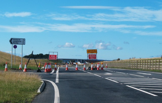
Image: © Gordon Hatton Taken: 22 Aug 2016
The newly opened section of A6055 to the north of Leeming Bar currently [August 2016] goes this far and no further, unless you wish to visit Goskins Farm. So here one must turn left into the narrow Bowbridge Lane which heads towards Hackforth. In the distance can be seen a new bridge over the upgraded A1[M], which I suspect carries this new road over the motorway and onwards towards Catterick. Only a matter of time before we can find out.
Images are licensed for reuse under creativecommons.org/licenses/by-sa/2.0
Image Location
Latitude
54.335748
Longitude
-1.593954